Climate & Health
- Climate and Health Home
- About Us
- Climate and Health in Minnesota
- Agriculture and Food Security
- Air Quality
- Diseases Spread by Ticks and Mosquitoes
- Extreme Heat
- Planning for and Responding to Extreme Heat
- Water Changes
- Wellbeing
Resources
- Discussing Climate Change with Patients
- Minnesota Outdoor Air Quality Guidance for Schools and Child Care
- Climate and Health Stories
- Planning Tools and Publications
- Trainings and Resources
Related Topics
Environmental Health Division
Planning Tools and Publications
Planning for climate and health impacts: Emergency management considerations
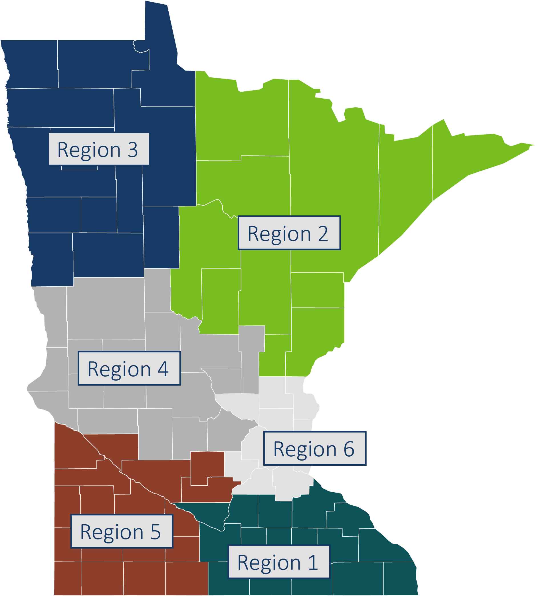
Minnesota is experiencing an increase in the number and strength of weather-related natural disasters. Emergency management professionals are on the front-lines of responding, but often lack access to and understanding of climate trend data to help plan for and minimize the risks of impacts from extreme weather events. As a way to help planners and decision-makers in emergency management and related fields understand regional climate trends, the Minnesota Climate & Health Program developed climate and health data profiles tailored to each of the six Homeland Security and Emergency Management (HSEM) regions across the state.
Each regional profile includes a description of climate change trends along with a summary of climate and population projection data. Additionally, each regional profile provides a local case study to illustrate the links between extreme weather and natural disasters and what climate projection data can (and can’t) indicate for similar events in the future. This resource provides a framework for discussing projected local risks related to our changing climate and supports the development of climate adaptation strategies that protect community health and safety.

- Region 1 - Southeast Minnesota (PDF)
- Region 2 - Northeast Minnesota (PDF)
- Region 3 - Northwest Minnesota (PDF)
- Region 4 - West Central Minnesota (PDF)
- Region 5 - Southwest Minnesota (PDF)
- Region 6 - Metro Minnesota (PDF)
County-Level Projection Data for Emergency Management
This data set includes projected temperature, precipitation, and population data for Minnesota's 87 counties. It is intended to assist with local, regional, and state resiliency planning.
To access a recording of the Planning for Climate & Health Impacts: Emergency Management Considerations webinar hosted on August 22, 2018, visit our Climate & Health YouTube Playlist.
Whitepaper (Updated January 2022)
To learn more about the development of the regional profiles and lessons learned, see the whitepaper: Advancing Health & Disaster Resiliency in Minnesota: Co-producing Climate & Health Information for the Emergency Management Sector (PDF). This paper includes:
- A detailed description of the effort, including the literature review, interviews, workgroup proceedings, and surveys that informed the development and content of information products.
- Survey results of emergency manager attitudes, intentions, and perceived barriers regarding climate projection data.
- Discussion of advancing disaster resiliency, including the role of state agencies as boundary organizations, the power of framing climate data with local impacts, and the need for better downscaled climate project data accessible to the public.
- Lessons learned to advance a path forward for others interested in adopting and adapting this project for their state and local jurisdictions.
Minnesota climate and health profile
The Minnesota Climate and Health Profile 2015: An Assessment of Climate Change Impacts on the Health & Well-Being of Minnesotans summarizes the historic climate trends, future projections, and likely impacts of climate changes on the health of Minnesotans. The report explains the pathways between identified Minnesota climate hazards (i.e., air pollution, extreme heat, flood, drought and ecosystem threats, including vector-borne diseases and harmful algal blooms) and their corresponding health impacts.
Minnesota climate change vulnerability assessment
The Minnesota Department of Health (MDH) developed the Minnesota Climate Change Vulnerability Assessment to assess the historic occurrence of the following “climate hazards” for the state of Minnesota: extreme heat events, air pollution, vectorborne diseases, flooding, and drought. MDH also mapped vulnerable populations to each of the climate hazards by county. The assessment found that the climate hazards have affected every county to varying degrees and that all counties contain vulnerable populations.
With this information, state and local government, companies, institutions and community organizations can begin important discussions about the risks of climate change to their communities, how best to prepare for them, and how to protect everyone, including the most vulnerable, to ensure a healthy and prosperous state.
